The Case for Local Landscape Designation
The primary document was compiled by members of the project team and can be downloded in .pdf format here: Outline Case for Local Landscape Designation. The information below has been précised from The Case. Detailed, more technical reports, on some of the subjects stated below, have been produced but are not currently available for download. To request, please e-mail the project team.
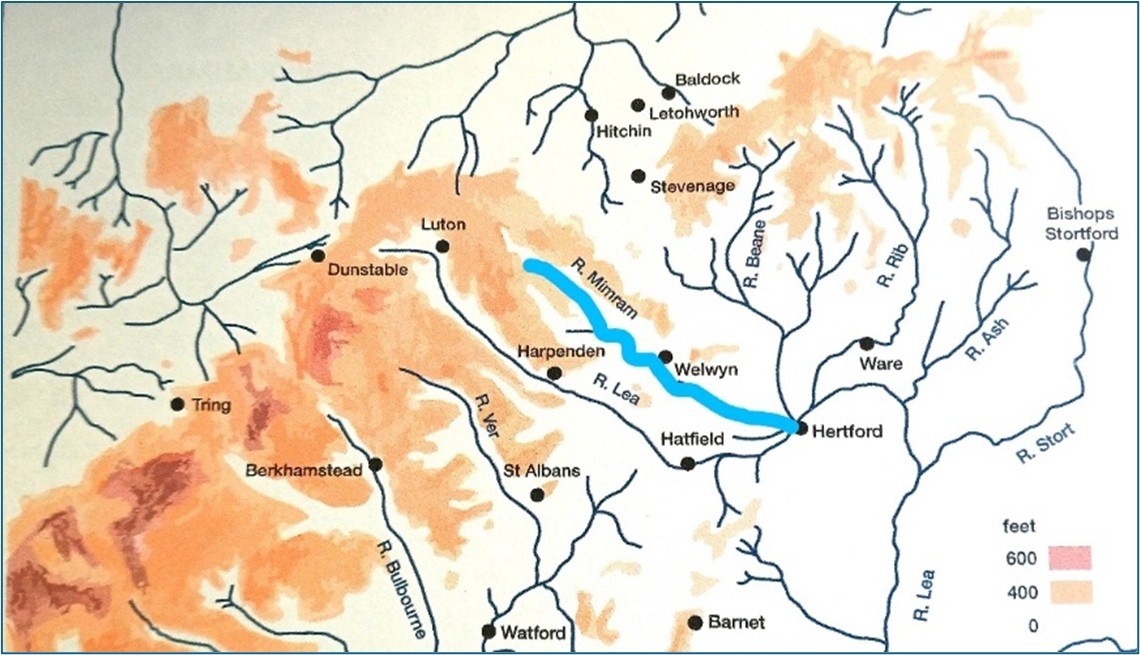
The Mimram Valley
The valley accommodates numerous areas of special environmental interest for landscape, heritage, wildlife and culture. The River Mimram is one of the finest stretches of chalk river in Hertfordshire. The Local Landscape Designation proposal relates to the Mimram Valley as defined by landscape and topography and not the catchment area which is far more extensive.
Landscape, Land Use & Farming
The valley is valued for its distinctive natural chalk stream and sequence of parkland landscapes. There are a large number of historic churches, manors, former grain and fulling mills, former (local or estate) breweries and bridges bearing witness to the important heritage and cultural value of the Mimram Valley. The Valley slopes include numerous ancient woodlands standing among arable fields bounded by hedgerows and veteran trees. Together with pastoral floodplains and wild flower meadows, they provide a richly biodiverse habitat.
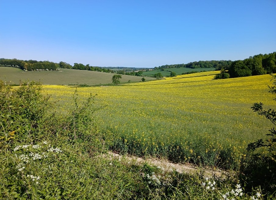
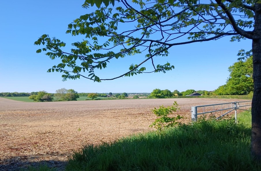
In the upper Mimram Valley, arable agriculture predominates presenting a semi-rural rolling landscape with sporadic settlements and areas of woodland.
In the lower Mimram Valley, urban development is more in evidence and the landscape character is more enclosed.
History
King’s Walden, St Paul’s Walden, Bendish, Kimpton, Knebworth, Codicote, Welwyn, Ayot St Lawrence, Ayot St Peter, Digswell, Tewin, Hertingfordbury and Hertford are within or adjacent to the valley, and are all mentioned in Domesday Book
Historic Parks and Gardens
Historic England, Hertfordshire Gardens Trust, East Herts DC and Welwyn Hatfield BC maintain lists of nationally and locally designated historic parks and gardens. Within the Mimram Valley corridor there is a concentration of these national designated landscapes, as well as local significant assets. Early evidence of parks and occupation from Saxon times are found in Hertingfordbury Park and at Kings Walden Park which, although not a park at the time, is of Saxon origin. Medieval parks were at Hertingfordbury (the hunting park for Hertford Castle) and Kimpton. Later parks were laid out further along the valley at Lockleys – a late 17th century park and St Paul’s Walden Bury – a Grade 1 outstanding early 18th century ‘Forest Garden’. In addition to the work of Brown and Repton (see below) several later C18/early C19 parks were also laid out including Ayot St Lawrence, Danesbury and Hertingfordbury Rectory. Other significant gardens are at Epcombs, dating from the C17 and at Hertingfordbury Rectory (once part of Hertingfordbury Park). Many of these parklands also include historic buildings and interesting features, such as the Fernery at Danesbury or the “Greek Temple” at Ayot St Lawrence. These estates often have elevated positions, affording long views both across and along the valley. Only three properties are in the valley bottom – Lockleys, Epcombs and Hertingfordbury Rectory. “Industry” such as breweries, mills and tanyards were once features in the valley, as well as farming, which included watercress beds and osier beds.
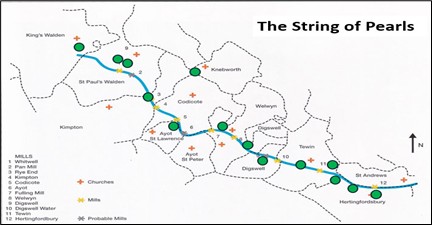
Brown (1715 – 1783) & Repton (1752 – 1818)
Two major landscape designers are associated with the parklands of the lower Mimram valley: Lancelot “Capability” Brown (Panshanger, The Hoo at Kimpton, and Digswell), and Humphry Repton (Panshanger – subsequent to Brow – and Tewin Water. Panshanger Park was originally associated with the house – now demolished. A eriod of gravel extraction followed but on its cessation, the park has now been restored and is fuly accessible for walking around. Repton modified Brown’s original design for the park. Tewin Water House is a private residence but the remnant of the parkland can be walked. Apart from the scenic impact of his work, Repton is credited as saying: ‘The whole of the beautiful valley from Welwin (sic) to Hertford including Digswell, Tewin Water and Cole Green, belonging to the same noble family ….. While each possesses its independent privacy and seclusion, their united woods and lawns will, by extending through the whole valley, enrich the general face of the county’. Repton also coned the title “String of Pearls“.
Historic Houses
The principal buildings/estate houses are listed by Historic England as follows.
Grade I : New Church at Ayot St Lawrence
Grade II* : Old Church at Ayot St Lawrence; Ayot St Lawrence House; Lockleys (near Welwyn); Marden Hill (near Tewin); St Paul’s Walden Bury.
Grade II : Danesbury House (near Welwyn); Digswell House (now within Welwyn Garden City); Stagenhoe (near King’s Walden); Hertingfordbury Park; Tewin Water House (near Digswell Water and Tewin).
Locally Designated : Epcombs (near Hertingfordbury); Kings Walden Bury.
The houses at Panshanger and Kimpton Hoo were demolished in C20. However, Panshanger Park still retains a listed orangery and conservatory, walled kitchen garden and gardener’s house as well as an ice house, underground store and barn. Kimpton Hoo Park includes a listed bridge by William Chambers which carries the entrance drive over Capability Brown’s broadwater.
Natural Assets
Throughout both the upper (Whitwell to Welwyn) and lower valley (Lockleys to Hertingfordbury and the confluence at Hertford) there is a range of nationally and locally designated wildlife sites, nature reserves, ancient woodlands and historic parklands, with veteran trees, grasslands, water bodies, fen, swamp and hedgerows. The river tself is a spring-fed chalk stream, one of only some 200 in the world and as such, is of international importance as a rare habitat. It provides valuable aquatic, semi-aquatic and marginal vegetation supporting fish, invertebrates, birds and mammals.
Nationally Designated Sites
Sites of Special Scientific Interest (SSSI): There is one SSSI located at Tewinbury in the lower valley, with a range of wetland habitat types actively managed by the Herts and Middlesex Wildlife Trust. A wide range of rare plants and uncommon bird species as well as water vole can be found. A further site (Sherrardspark Wood, near Ayot Green) comprises ancient woodland (mainly sessile oak and hornbeam).
Ancient Woodland sites: There are 22 ancient woodlands (continuous woodland cover for over 400 years) in the corridor which are listed in the Ancient Woodland Inventory. These are generally oak/hornbeam woods typical of Hertfordshire. Of the 16 woods in the upper valley, 6 are Ancient Semi Natural Woodland (ASNW) and 10 are Plantation on Ancient Woodland Sites (PAWS). The lower valley has 6 ancient woods, 4 of which are ASNW and 2 are PAWS.
Local Nature Reserves (LNR): There are two reserves in the upper valley (Singlers Marsh and Danesbury Park) both near to Welwyn village, and two in the lower valley (Willowmead – near Hertford – and Archers Green – near Tewin).
Locally Designated Sites
Local Wildlife Sites (LWS): There are 82 LWS in the corridor. The upper valley has 18 sites of woodland, 24 of grassland (24 sites), and 9 of fen and swamp associated with the river, the remainder being (small) buildings often associated with the presence of bats, such as disused icehouses. The lower valley has 7 sites of woodland, 11 of grassland, 4 of wetland, 8 riverine and 6 involving buildings and areas associated with bats. Panshanger Park in particular: part of it is a LWS and notable for its water bodies, large areas of grassland, fen, swamp and woodland with some 800 veteran trees including the Blackadder and Panshanger oaks. The area is also notable for its resident and migratory birds, mammals, dragonflies, moths, butterflies and rare dead wood beetles. The River Mimram at Panshanger Park has important fish and crayfish populations.
Species
Plants: Inerest in both the upper and lower valley centres on ancient woodland communities, wetland plants associated with the river and fen together with swamp areas near to the river. Some 692 higher plant species have been recorded together with diverse fungal, lichen and moss flora
Mammals: Those found in the corridor are typical of rural Hertfordshire including fallow deer, muntjac deer, grey squirrel, mole, badger, rabbit, hare, fox, stoat, weasel, harvest mouse, field vole, bank vole, common shrew and pygmy shrew. Water based mammals include declining populations of invasive mink due to intervention management and increased sightings of water vole and otter. The habitat mosaic also supports 10 species of bats.
Birds: Specialist woodland birds appear to be in decline as are insectivorous birds. Spotted flycatcher and marsh tit have been lost to the valley in recent years but there has been a big increase in red kite and buzzard populations. Skylark numbers have also shown an increase recently. In the lower valley, broadleaved woodland and grassland attract woodpeckers, tree creepers, nuthatch, barn owl, tawny owl and birds of prey such as kestrel and hobby. The larger water bodies at Panshanger and Digswell Lake attract a wide range of wetland birds both resident and migratory including coot, moorhen, heron, egret, cormorant, geese, swans, wildfowl, waders, sedge warblers, Cetti’s warblers and kingfisher. Swifts and swallows appear as summer visitors.
Aquatic: The river and associated lakes and ponds are home to 21 species of fish including brown trout, dace, loach, grayling, 3-spined stickleback, brook lamprey and crayfish. Invertebrates make up about 60% of the species records held.
Insects: There are diverse and important populations of moths, beetles, ants, wasps, butterflies, river flies, dragonflies and damselflies.
Cultural Interest
Each community in the valley once benefitted from its own church and school. Some smaller schools have long since been absorbed into adjacent villages, but some evidence remains: social history frozen in time with the preserved (frequently repurposed) buildings. The concentration of so many artefacts and treasures of social history in a single location affords opportunity for school children (and adults!) to benefit from ‘on site’ experiences. Most communities manage to sustain a pub and village hall but local mills – both grain and cloth fulling, have long closed and been repurposed as private residences. Nevertheless, the historical relationship between church – school – rectory – manor house – estate – mill – pub, can still be appreciated in many parts of the Mimram Valley.
The valley is very accessible – on foot, cycle or horse and by car or rail: the Great Northern Railway, the Great North Road, and the adjacent A1(M).
The valley is traversed by many footpaths and bridleways, plus two National Cycle Routes. There is a network of well used footpaths and public rights of way, which provide access to points of interest and panoramic views of the valley. A near-continuous 15 mile walk already exists from its Stagenhoe source to the confluence with the River Lea at Hertford: Kings Walden – Stagenhoe – Whitwell – Hoo End – Hoo Park – Hoo Bridge – Rye End – Kimpton Mill – Codicote Mill – Ayot Lodge – Ayot House – Ryefield Farm – Linces Farm – Singlers Marsh – Welwyn Village – Lockleys – Digswell Viaduct – Tewin Lodge West – Tewin Water – Westley Wood – Tewinbury – Tewin Mill – Archers Green – Poplars Green – Panshanger Park- Hertingfordbury Mill – Cole Green Way – Hertford Town Football Ground. The Mimram Trail is a future project to improve the relationship of the walk and the river, provide waymarking and information boards and possibly include detours to other points of interest.